The Ministry of Natural Resources – North Bay District is advising area residents that a Watershed Conditions Statement - Flood Outlook bulletin is in effect for the district until Friday, March 21, at noon.
A WATERSHED CONDITIONS STATEMENT – FLOOD OUTLOOK gives early notice of the potential for flooding based on weather forecasts calling for heavy rain, snowmelt, high winds or other conditions.
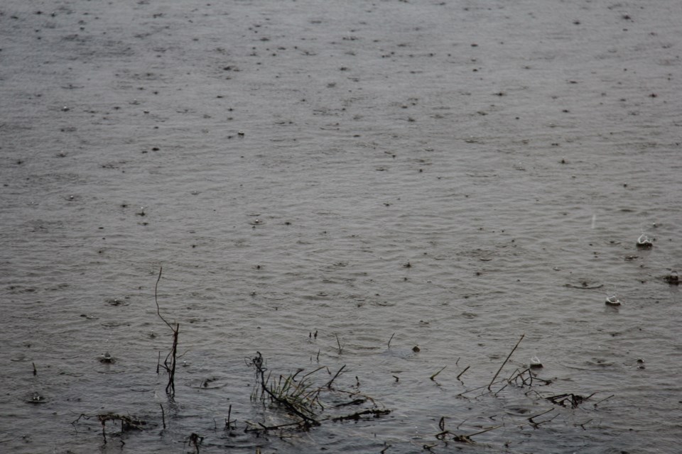
Residents should keep a close watch on conditions and exercise caution around lakes, rivers and streams. The warm temperatures and rainfall forecasted for Saturday and Sunday are likely to impact low-lying areas with a history of flooding. Shoreline and ice conditions are also expected to be impacted. Please alert and/or monitor any children and pets under your care to possible dangers and supervise their activities around waterbodies.
See related: Significant rainfall is possible this weekend
The ministry is closely monitoring the weather and developing watershed conditions. Further updates will be issued as appropriate.
Description of Weather System
A major low-pressure system will be moving through the province from Friday to Monday, bringing warm temperatures and rain to most of the province. All areas of the district could receive minimal rainfall overnight Friday before precipitation amounts increase over the weekend. Starting Friday, temperatures are forecast to be well above the freezing mark until Sunday evening when they will drop below freezing which will decrease the impacts of this weather event.
Northern reaches of the district could receive up to 30 millimetres of rain from Saturday morning until Sunday evening, with the possibility of most rain expected to fall on Saturday. Southern reaches of the district could receive up to 40 mm of rain over the same period, again with the possibility of most rain expected to fall on Saturday.
Description of Current Conditions
Significant snowpack remains across the district. Lakes and rivers in the northern reaches of the district are still frozen, while those in the southern reaches are starting to see the beginning of open water in limited areas. Water levels and flows across the district are currently low, and it’s expected that they will respond accordingly to this weekend’s rainfall event combined with temperatures remaining well above zero until Sunday night.
See also: Ice removal reduces flood threat
The mild weather observed over the last few days allowed for a reduction in the depth of snow due to melting, compaction and sublimation. It’s estimated that the current density of the snowpack is increasing because of recent rainfall and warming temperatures. As a result, the snowpack has a limited capacity to absorb rainfall, and runoff is expected to occur. It’s expected that shorelines will become increasingly unstable and ice conditions will deteriorate significantly.
Rainfall and snowmelt could result in potential flooding in low-lying areas with a history of flooding. Residents in these areas are encouraged to monitor conditions and prepare accordingly.
Later Friday, a Flood Outlook was also issued for the North Bay-Mattawa watershed, according to the North Bay-Mattawa Conservation Authority
(NBMCA).
“A Special Weather Statement was issued by Environment Canada for the North Bay – Powassan – Mattawa area, forecasting 20-40 mm of rainfall late Saturday (Mar 15) through Sunday night, with the possibility of localized areas receiving more,” stated Angela Mills, NBMCA Flood Duty Officer. “Temperatures are above freezing and are forecast to remain mild through the weekend with highs above 10C and temperatures remaining above freezing through Sunday. The combined mild temperatures and rainfall are expected to trigger snowmelt and runoff.”
Water levels on area lakes and rivers are generally normal for this time of year. Moisture content in the snowpack is an average of 148.7 mm (as of March 14), which is above normal for this time of year. After recent mild temperatures and rain, the snowpack has limited capacity to store additional moisture. Water levels in the watershed will increase, and localized flooding is possible in low-lying areas. Increased flows may impact shoreline ice stability, especially near creeks. Widespread flooding is not expected at this time.
Friday was a scheduled Snow Survey day. NBMCA measures snow depth and water content as part of its Flood Forecasting and Warning Program. Snow depth decreased by 3.8 cm and snow water equivalent increased by 32.3 mm since March 7.